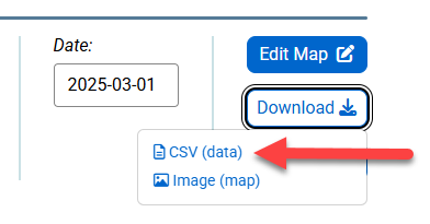
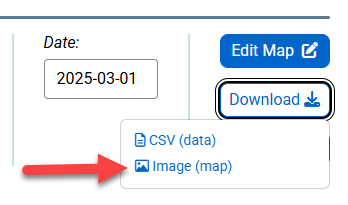
To export data, click the "Download" button above any FRED map and then select “CSV” (comma separated values [.csv]).
A “Download Data” window will open. The dates can be modified by either clicking in the Date field and manually entering a date (in the YYYY-MM-DD format) or by clicking on the Date field and selecting a date from the date picker, then click on the “Download” button. The data values will download into a spreadsheet.
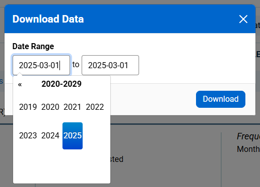
Example of CSV download option.
The “Image” option exports the visual display of the map. Select this for a general-purpose display (.png) of the map.
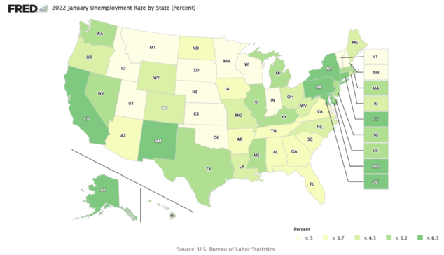
Example of Image (.png) option.